

What Walk Score Tells Us About Durham
Redfin's simple tool shows us how to build a better city

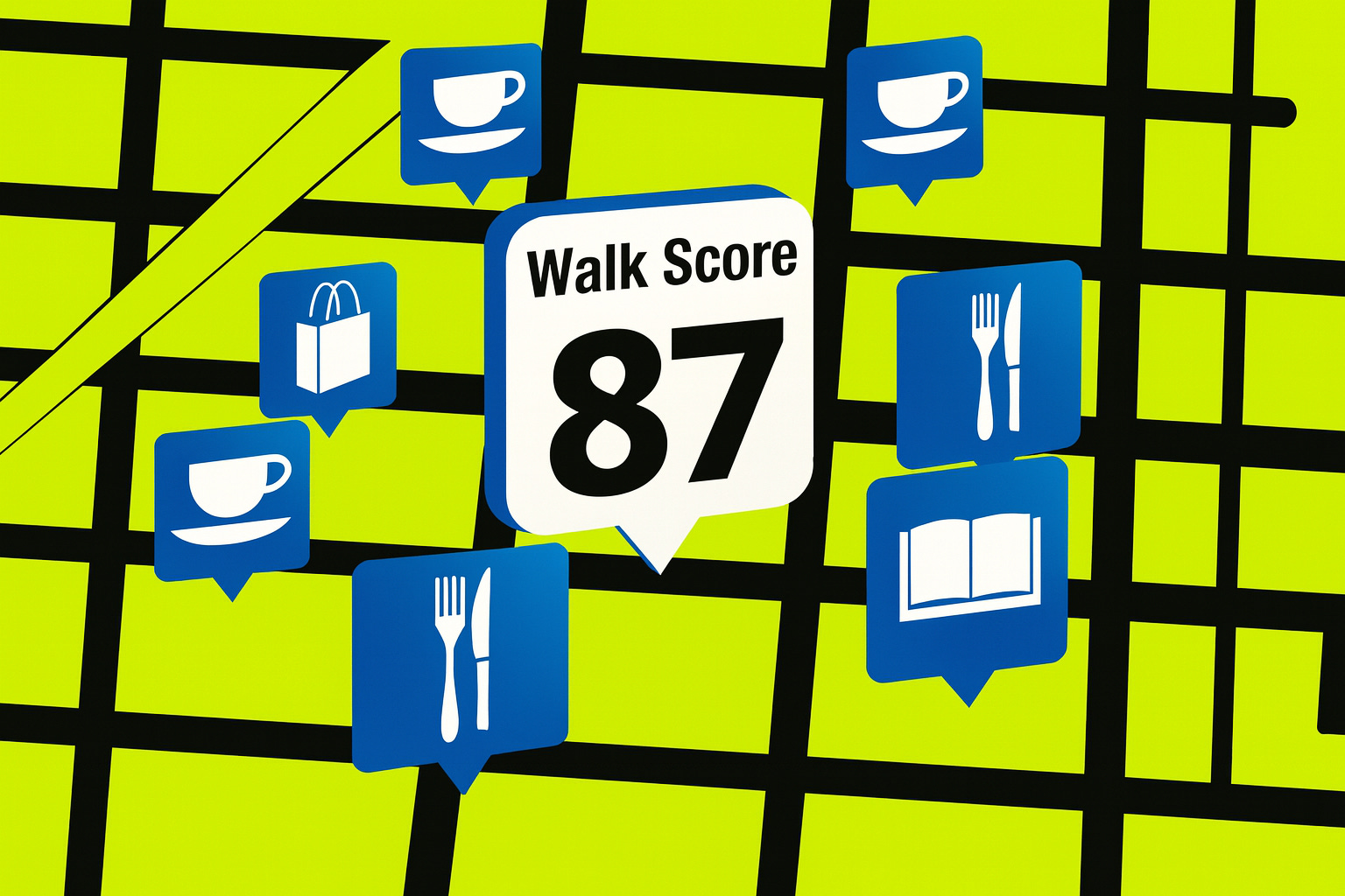
Jeff Speck is one of the most influential voices in modern city planning. His book Walkable City has become a field guide for urban designers, and his most famous promotion—the Walk Score—has become a household term. Founded by Mike Mathieu in 2007, Walkscore allows you to type in any address in America, and you’ll get a number between 1 and 100 telling you how walkable the area is. Over time, Speck expanded the tool to include Bike Score and Transit Score. Together, they provide a snapshot of how easy it is to move through daily life without a car.
Why Walk Score Matters
Walk Score isn’t just a planning gimmick—it’s about quality of life and affordability. Car dependency is one of the most underappreciated costs in a household budget. According to Experian, the average new car payment is now $745, or $9,000 a year, and that’s before gas, insurance, and maintenance. While nearly all American households still need a car, a high Walk Score can be the difference between needing two cars and needing one.
Meanwhile, people consistently say they want to live where walking is possible. Zillow now incorporates Walk Score into its platform because homebuyers are willing to pay more for that convenience. Developers and economic development departments also use it to underwrite retail and commercial projects.
The benefits don’t stop at money. Higher Walk Scores correlate with healthier lifestyles, though part of that is self-selection—healthier people often choose to live in walkable neighborhoods. Still, the trend is clear: people want to live near the coffee shop, the bar, or the grocery store, not just the nearest on-ramp.
My Walk Score Story
I learned the value of Walk Score the hard way, while house hunting right after I got married. My wife and I narrowed our choices to two extremes: either we would live deep in the country, immersed in nature, or we would live somewhere with easy walkability.
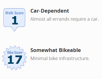
One option was out on Mount Sinai Road near Duke Forest. It had the lowest Walk Score I’d ever seen: a one. No bike infrastructure, no transit, completely car dependent.
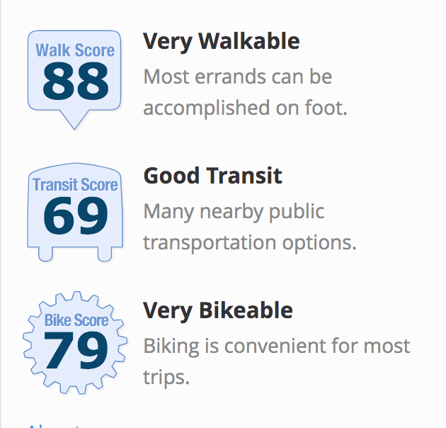
The other option was a neighborhood near downtown Durham. The house we chose scored an 88 for walking, 69 for transit, and 79 for biking.
There’s nothing wrong with choosing the country, and I respect those who do. But for us, I’m convinced the decision to go walkable shaped our quality of life. Raising kids, staying social, and keeping our lives affordable have all been easier thanks to those high Walk, Bike, and Transit numbers.
What Durham’s Walk Scores Reveal
So what can Walk Score teach us about Durham’s future? The data indicates that we need to focus on creating more walkable and bikeable areas. I’d argue these two standards matter even more than transit.
Right now, about 5% of Durham commuters use the bus, which is high by southern standards, and just 1–2% ride their bikes. By contrast, Madison, Wisconsin, boasts a bike mode share of around 10%, and Davis, California—America’s gold standard for bicycling mode share—tops 20%.
Imagine one in five trips in Durham happening on a bike. That’s transformative.

Of course, we’re not talking about the entire city. Durham covers 115 square miles, but the walkable, bikeable core is really only about 12. If we created just one square mile within the city designed explicitly for biking and walking—say, the stretch between Duke University and downtown—it could become one of the most attractive neighborhoods in the South for people who want that lifestyle.
Walk Score helps us picture this future. It doesn’t just measure what we have—it points to what we could become.
The drawing cannot begin soon enough.
Correction: an earlier version of this essay suggested that Jeff Speck created Walk Score, which is inaccurate. It has been corrected, with proper attribution given. We regret the error.
My walk score is atrocious unfortunately! Trying to improve the biking at least here.
Where did you read that Jeff Speck invented the walk score? He's not listed as one of the founders